Showing posts with label Travel. Show all posts

Friday, May 06, 2016

Reflecting on Nature


While sorting through a few archived images for a project, I was struck with how many of them had one striking feature in common: reflections. Whether in sea water, glass or even wet pavement, this simple phenomenon has the power to captivate. I have to admit that I'm pretty much addicted to them. Sometimes the morning sun's low angle sets off a perfect combination of elements to create an unforgettable image.


Sometimes it's the evening light that does it, turning marsh grass to gold, deepening the colours of the blue-grey clouds and painting the granite rocks a stark white, like this scene in Atwood's Brook, NS.


Blue Rocks, Nova Scotia, is a picturesque spot at any time, but the touch of the early morning sun on the golden shades of autumn can make it even more beautiful.


Evening's soft rose tones on a winter day can create a Rorschach sunset around the inshore islands. This is another scene from Atwood's Brook, NS.


A few sanderlings scouting for food at the water's edge make for some striking reflections in the wet sand of Daniel's Head Beach, Cape Sable Island, NS.

Tuesday, March 15, 2016

Walking on the Moon -- Newfoundland's Tablelands

Last winter's snow
Gros Morne National Park is a wonderland for geologists and hikers alike. One of its best-known features is a range of flat-topped hills beside Route 431 just outside the town of Woody Point -- a spot known as the Tablelands. The rusty orange tone of the hills comes from the peridotite that is their main component; when it's freshly exposed, this rock is a dark grey-green, but with oxidation it takes on a mellow golden tone. This rock is part of an exposed section of the earth's mantle; further metamorphic activity turns it into a rock called serpentinite, examples of which can be widely found here.


Gros Morne's Tablelands
Earth's mantle? That's right -- this is a section of rock that was once deep below the earth's surface, formed roughly 1.2 billion years ago. The process of continental drift several hundred million years ago forced this mantle rock upward, and subsequent erosion has given the hills their present form. They remain barren because the peridotite is low in life-sustaining nutrients and contains toxic concentrations of heavy metals. What vegetation that is found here is mostly along an old roadbed, on rock that was brought in for the purpose of road building. A well-maintained trail follows this roadbed, crossing Winterhouse Brook, which flows out into Bonne Bay just outside Woody Point.

Round-leaved sundew (Drosera rotundifolia)
A walk along this trail reveals a surprising number of small, hardy plants that have developed the survival tactics necessary for such a forbidding environment. Many of them, like pitcher plants, butterwart, and the round-leafed sundew shown at left are insectivorous; instead of obtaining all their nutrients from the soil, they attract insects and through a variety of processes absorb the life-giving substances they need from the insects themselves or from their droppings. It's not an easy life, to say the least.


Winterhouse Brook
Continue along the trail as far as Winterhouse Brook (right), where snowmelt and run-off from the tops of the Tablelands form a swift-running stream. This area has a challenging winter climate, and a heavy snow load on the upper slopes often persists into late summer. If you think this place looks strange and otherworldly you're not alone. In fact, the landscape here is so forbidding that NASA has sent research teams here to investigate the area's similarity to the surface of Mars. On a beautiful summer day, though, it's a beautiful and fascinating little corner of Earth, and well worth a side trip. Woody Point is located on Newfoundland and Labrador Route 431, about 70 km from the town of Deer Lake. It has a motel, bed and breakfast accommodations and campgrounds nearby, and there are shops, restaurants and other services, and is roughly an hour away from Rocky Harbour. Parks Canada's Discovery Centre has high-quality informative displays, park information and a gift shop.

Woody Point and the Tablelands

Wednesday, March 02, 2016

Life on the Rocks in Point Riche

Marine gastropod fossil
One of my favourite moments during a visit to western Newfoundland is the "life on the rocks" exploration of Point Riche. The headland lies near the town of Port-au-Choix, on the island's Great Northern Peninsula, and its white octagonal lighthouse with a bright red lantern room is a striking sight. Below the lighthouse, though, is where this spot's treasures are found. In the broad limestone beds on the shore, thousands of marine fossils, mostly cephalopods and gastropods can be seen.  It takes only a moment for the eye to become accustomed to the search; when it has, a scan of the rocks reveals one tight spiral after another, sometimes dozens within a space the size of a small notebook.

Fossils at Point Riche
Among the fossils are tidal pools that evaporate quickly in the summer sun, leaving a rim of salt around their edges. In the cracks of the rock, tiny plants take root in the most challenging of circumstances. Minke whales, seals and dolphins can occasionally be seen passing by, and when there are small fish like capelin or juvenile herring in the area, northern gannets knife into the water. There is a small herd of caribou living in the area, and a few moose can also be seen from time to time.

The limestone barrens on the Northern Peninsula are home to many varieties of calcium-loving plants, some of them found only in this environment, so it's necessary to tread carefully on the plateau above the shore. Just up the road, also part of the Port-au-Choix National Historic Site, is an interpretation centre that concentrates on the area's remarkable human history; a succession of occupations of the area by various cultures go back some 6000 years.

The nearby towns of Port au Choix and Port Saunders are centres for fishing in the area, and there are restaurants, hotels and other services nearby.


A miniature garden among the rocks


Wednesday, February 24, 2016

Coming back to Nain

Nain's brass band
There's a little community in Nunatsiavut that I've loved since the first time I visited -- it's the northernmost inhabited community in the province of Newfoundland and Labrador, and the largest community in Nunatsiavut and its administrative capital. I first visited Nain in 1994 via the M.V. Northern Ranger, as part of a cruise along the coast. In those days, the Ranger operated out of Lewisporte on Newfoundland's northeast coast, and the trip took in all the small ports along the way, including St. Anthony, Red Bay, and Cartwright on the way to Goose Bay - Happy Valley. Today the vessel still runs, but it's now operated by Nunatsiavut Marine and plies the coast only from Goose Bay northward, stopping at Rigolet, Makkovik, Postville, Hopedale, and Nain, with a stop in the Innu community of Natuashish as well.

On the roof!
My most recent visit, though, was from a different vessel: the Ocean Endeavour, operated by Adventure Canada. I was delighted to see that Nain would be one of the stops on their Newfoundland and Wild Labrador cruise in 2015, and was eager to return to the place where there were so many wonderful memories. The icing on the cake was that the stop happened to fall on my birthday, July 11.

Carver John Terriak


In the years since I'd been to Nain, a very important development had taken place: the local brass band, established by the Moravian Church as part of its outreach to the coast, had been resurrected through the efforts of a dedicated group of volunteers and advocates including Dr. Tom Gordon of Memorial University, who was a fellow staffer on the Adventure Canada team.When the Ocean Endeavour arrived, the band was there to greet us -- and after a welcome at the little white church near the public wharf, the band members followed tradition and climbed from the church tower onto the roof to play so the sound would carry better!

Pitsik
The welcome in Nain was as warm as ever, thanks to Tourism Nunatsiavut, and there was time to explore the community, see a demonstration of soapstone carving by noted carver John Terriak, taste some local delicacies like partridge soup and pitsik -- dried char -- and do a bit of shopping for soapstone, sealskin, knitted goods and other keepsakes before a reception with Inuit games at the local school; a buttery-soft sealskin eyeglass case seemed like the perfect birthday present, and by chance, the young man who sold it to me was celebrating his birthday as well -- along with his twin brother! We wished each other a happy birthday, and I was on my way.

The perfect keepsake

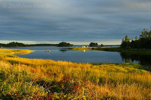
It was a delight to return to this little spot after an absence of nearly twenty years; I've promised myself it won't be so long before my next visit. Nain is on the itinerary of Adventure Canada's Greenland and Wild Labrador
cruise for 2016.

Leaving beautiful Nain

Saturday, May 25, 2013

Headed for Twillingate and the Bergs!

I got an inquiry this week from a couple wanting to see icebergs in Newfoundland. Could I take them to Twillingate? Absolutely!

With changing weather conditions, the bergs seem to be moving inshore, and there are reports of two bergs at Long Point, very close to the lighthouse. Stay tuned -- I'll be there late tomorrow afternoon and there will be another post then, with photos. Meanwhile, here's one of a berg at sunset, taken from Twillingate a few years ago.


Wednesday, May 22, 2013

First Visit to the Cape


The first spring visit to Cape St. Mary's always reminds me what a wonderful and varied place this is. Known primarily as a nesting site for thousands of northern gannets, it also provides a feeding ground for bald eagles and ravens, typical habitat for savannah sparrows and horned larks, and forms part of the range of the southern Avalon caribou herd.


I arrived in the early morning and started down the trail from the visitor centre; visible even from this distance, a juvenile bald eagle (Haliaeetus leucocephalus) was circling high above the cove, the sun highlighting its mottled colours.


Another few minutes of walking brought me to the main point near Bird Rock, the centre of the gannet (Morus bassanus) nesting area.  This point overlooks the rock, and in another month it will be possible to spot the first of the year's chicks, guarded by their protective parents. Now, though, it's only adult birds that are visible, soaring overheard or returning to the nesting sites with seaweed or twine for nest repairs.


Returning along the trail, I heard the unmistakable trill of a savannah sparrow (Passerculus sandwichensis) from just ahead. There it was, perched on one of the stakes that mark the trail.


The day's real treat, though, came in the form of a handful of caribou (Rangifer tarandus) trotting across the Eastern Hyper-oceanic Barrens. They were a hundred metres away, and seemed unconcerned at my presence. They'll soon begin to shed their pale winter coats, taking on a darker, sleeker look for summer. It will be fascinating to watch the changes that take place here at the Cape between now and October.

Monday, May 20, 2013

Playing the Hand You're Dealt


A long-planned excursion to the town of Twillingate this weekend turned into an object lesson in the difference that attitude can make. The trip was scheduled to take place over the Victoria Day weekend; Victoria Day is a Canadian holiday that is now celebrated on the Monday prior to May 24, the actual anniversary of her birth in 1819. In Newfoundland and Labrador, the holiday has a largely undeserved reputation for bringing what could most generously be called interesting weather, but this year it came through in fine fashion. Snow began falling on Saturday evening, and continued all day Sunday in Central Newfoundland, dumping some 58 cm (roughly 22.8 inches) in the town of Gander. At Twillingate, on the coast, accumulations were not as great, but there was a good coating of slushy snow on the roads and streets, and steady snow in the air.


At the Harbour Lights Inn in Twillingate, a motley crew of travellers from many parts of Canada showed the best possible reaction to an event like this one -- they took it in stride. Laughter filled the air, and all the guests in the nine-room inn carried on with their plans to explore the area. It wasn't just the hardy crowd at the Harbour Lights who showed this kind of moxie, though. Throughout our exploration, many other travellers could be seen taking photos, enjoying a meal at a local restaurant, or taking in the sights.


By the time the storm ended on Sunday, an iceberg had drifted into view on the horizon and there were already groups visiting the viewing area near the lighthouse at Long Point to catch a glimpse of it, and to marvel at the rime of ice that had formed on the nearby tuckamore as a result of the combined wind and icy spray.


According to Environment Canada, this is the first time in over ten years that there's been significant snowfall in Newfoundland on the Victoria Day weekend; we've come to expect wonderful weather at this time of year, but this year we got fooled. When this kind of unexpected event arrives and plans have already been made, we can feel conspired against and cancel, or we can roll with the punches and make the conscious decision to enjoy life as it comes. On an occasion when a few grumbles might have been expected, there wasn't a single complaint to be heard. Full marks to this weekend's visitors to Twillingate for playing the hand that fate -- and the weather -- dealt them.


Wednesday, May 15, 2013

Tales from the Kyle


One hundred years ago, on April 17, 1913, the SS Kyle began her maiden voyage. Constructed in Newcastle Upon Tyne, UK, she was destined for use on the service between Carbonear, Newfoundland, and the coast of Labrador, and was used for a time on the crossing between Port-aux-Basques, Newfoundland and North Sydney, Nova Scotia. During World War II she transported soldiers from the Dominion of Newfoundland to Canada, and later in her career was fitted as an icebreaker. Operated by the Reid Company of Newfoundland as part of its renowned Alphabet Fleet, which got its name from the fact that the names of the company's vessels began with successive letters of the alphabet, each with a Scottish connection: Argyle, Bruce, Clyde, Dundee, Ethie, Fife, Glencoe, Home, Inverness, Kyle, Lintrose and the Meigle. These sturdy ships carried passengers and freight around the coast of Newfoundland and to and from Labrador; they were an essential part of everyday life for coastal residents from the 1890s until the mid-twentieth century. 


The Kyle became a beloved part of Newfoundland lore when storyteller Ted Russell of Coley's Point, Conception Bay, penned his poem about her as part of his Tales of Pigeon Inlet:

The Smokeroom on the Kyle

by Ted Russell

Copyright : The Estate of Ted Russell

Tall are the tales that fishermen tell when summer’s work is done,
Of fish they’ve caught, of birds they’ve shot, of crazy risks they’ve run.
But never did a fisherman tell a tale, so tall by a half a mile,
As Grampa Walcott told one night in the Smokeroom on the Kyle.
With ‘baccy smoke from twenty pipes, the atmosphere was blue.
There was many a “Have another boy” and “Don’t mind if I do.” 

When somebody suggested that each in turn should spin,
A yarn about some circumstance he’d personally been in.


Then tales were told of gun barrels bent to shoot around the cliff,
Of men thawed out and brought to life that had been frozen stiff,
Of bark pots carried off by flies, of pathways chopped through fog,
Of woodsman Bill who, barefoot, kicked the knots out of a twelve inch log.


The loud applause grew louder still when Uncle Mickey Shea,
Told of the big potato he grew in Gander Bay.
Too big to fit through the cellar door, it lay at rest nearby,
Until, one rainy night that fall, the pig drowned in it’s eye.


But meanwhile in a corner, his grey head slightly bowed,
Sat Grampa Walcott, eighty-eight, the oldest of the crowd.
Upon his weatherbeaten face there beamed a quiet grin,
When someone shouted, “Grampa, ‘tis your turn to chip in.”


“Oh, no boys, leave me out,” said Grampa. “Oh thanks, don’t mind if I do.
Ah, well alright boys, if you insist, I’ll tell you one that’s true.
It’s a story about jigging squids I’m going to relate,
And it happened in Pigeon Inlet in Eighteen eighty-eight.


Me, I was just a bedlamer then, fishin’ with my Dad,
And prospects for the that season, they were looking pretty bad.
Now, the caplin scull was over and that hadn’t been too bright,
And here was August come and gone and nar a squid in sight.


Day after day we searched for squid, ‘til dark from the crack of dawn.
We dug up clams and cock n’ hens ‘til even these were gone.
And still no squids so, in despair, we give it up for good,
Took our gear ashore and went cutting firewood.


Now, one morning, while out in the woods with all the other men,
And wondering if we’d ever see another squid again.
Father broke his axe that day so we were the first ones out,
And as we neared the landwash, we heard the women shout.


“Come hurry boys, the squids are in.” Well, we jumped aboard our boat,
And started out the harbour, the only crew afloat.
But soon our keel began to scrunch like scrapin’ over skids.
“Father,” says I, “we’ve run aground.” “Me son,” says he, “that’s squids.”


Said he, “The jigger, heave it out,” and quick as a flash I did,
And soon as it struck the water, ‘twas grappled by a squid.
I hauled it in and what do you think? As soon as he crossed the rail,
I’ll be darned if there wasn’t a second squid clung on to the first one’s tail.


And another clung to that one and so on in a string.
I tried to shake ‘em loose but Father said “You foolish thing.
You’ve got something was never seen before in Newfoundland.
Drop the jigger, grab the string and haul hand over hand.”


I hauled that string of squids aboard ‘til the boat could hold no more,
And then we hitched it in the risings and rowed for the shore.
Now the men were coming from the woods, they’d heard the women bawl,
But Father said, “Don’t hurry boys, we’ve squid enough for all.”


So Uncle Jimmy, he took the string until he had enough,
And, neighbour-like, he handed it on to Skipper Levi Cuff.
Well, from stage to stage that string was passed throughout the whole night long,
‘Til daylight found it on Eastern Point with Uncle Billy Strong.


Now Uncle Bill, quite thoughtfully, before he went to bed,
Took two half-hitches of that string ‘round the grump on his stagehead.
Next morning Hartley’s Harbour heard the news and up they come,
In a trap skiff with three pair of oars to tow the string down home.


And when Hartley’s Harbour had enough, the following afternoon,
That string went on from place to place until it reached Quirpon.
Now, what happened to it after that, well I don’t exactly know.
But some folks say that it crossed the Straits and ended in Forteau.


Yes, tall are the tales that fishermen tell when summer’s work is done,
Of fish they’ve caught and birds they’ve shot and crazy risks they’ve run.
But never did a fisherman tell a tale, so tall be a half a mile,
As Grampa Walcott told that night in the Smokeroom on the Kyle.*

In 1967, after long and varied service, the Kyle was retired at anchor in Harbour Grace; she broke free during a severe storm in that year and grounded just off Riverhead, where she can be seen to this day.  

*Click on the link to hear Ted Russell's "The Smokeroom on the Kyle" as told by his son Kelly.

Sunday, May 12, 2013

I Like Big Boats and I Cannot Lie

I've always loved working boats, both big and small to be honest, and there are few places better suited to someone with a love of such boats than Atlantic Canada. From the sandy shores of Prince Edward Island to the tides of the Bay of Fundy, shared by Nova Scotia and New Brunswick, to the rocky coast of Newfoundland and Labrador, this region has a wealth of boats of all shapes and sizes.


They can be found in small towns and big cities, tied up at wharves, riding at anchor, or moored "on the collar" in small coves whose names don't appear on any map. The unifying thread among all these boats is their utilitarian grace. They're built for work, not for show, but they have an innate beauty that's a bit poignant somehow, as if try as they will, they just can't help being graceful and elegant.


These days their hulls might be fiberglass, metal or even concrete, but there was a time when every one of them had been built from wood in a local boat shop. Examples of those older wooden boats can still be found if you're willing to look; they might be housed in museums where they're carefully studied for their lines, hauled up on the shore and falling into ruin, or -- in some rare cases -- lovingly patched and mended and still afloat after seventy-five or a hundred years of plying the North Atlantic.


I particularly like those parts of the region where there's a lot of individuality expressed in the colours of the boats; those bright reds and yellows and blues and greens add cheer to a foggy day, and from a practical standpoint of those who wait on shore, it's a lot easier to recognize the boat you're looking for when it rounds the headland making for home. Although today's navigational and safety equipment have reduced the hazards, fishing is still a dangerous way to make a living; here's wishing safe home to all those boats, and to those who travel in them.


Friday, May 10, 2013

Patterns in the Sand


Beaches are wonderful places for walking, running, digging for clams, watching birds or watching surf, listening to the rhythms of nature or perhaps doing absolutely nothing. One of the things I love most about them, though, is that beaches are, in a very real sense, living things. Each visit is met with a new and changing landscape; sometimes the changes are small and insignificant, while others, like those brought on by winter storms, are sweeping and more permanent in nature: wind-driven waves rip through protective dunes and spill onto the flats beyond, or tons of sand are moved offshore leaving rocks and gravel exposed. It can take years for major changes like these to reverse themselves.


Smaller, gentler changes, though, are here reward the careful observer. The breeze plays over the surface of the sand sculpting patterns that are particularly striking in the low-angled light of morning and evening, creating miniature desert or mountain landscapes. Return the next day or even a few hours later, and those landscapes will be altered: ridges lower or higher, textures smoother or coarser, new patterns overlying the old. As the tide changes, the water works in concert with the wind to form a new array of relief figures. The movement of breeze and water shift the small particles of sand and shell, sorting them by size and weight. Waves roll in along the swash zone, compacting the surface. Farther up the beach face lies the wrack zone, where seaweed marks the high tide line. Above this is the berm, the raised area where the sand is generally dry. In summer, this zone provides a vital nesting area for shore birds like sandpipers and plovers; their camouflaged nests are vulnerable to beach walkers, so it's crucial to stay below the tide line when walking.


I seldom visit a beach without a camera, and it's not there just for the birds or the waves or the cloud reflections; these erosion patterns are simply too tempting and to varied to ignore, and I love the way they mimic flames, waves, mountains and canyons -- or sometimes even characters from a Tolkien novel.  The constantly shifting personality of the beach at the seemingly subtle whims of moving air and water means that in nature, as in life, the only real constant is change. There's nothing like a metaphor you can photograph.


Tuesday, May 07, 2013

Comfort and Hospitality at the Clockmaker's Inn


The Clockmaker's Inn at Windsor, NS stands proudly at a spot called Curry's Corner; this stately home with its distinctive mansard roof was built in 1894 for local merchant Rufus Curry, who occupied it until his death in 1934; his widow, Cornelia, stayed on in the house until 1946.  After some thirty years, it was bought by Dennis and Veronica Connolly, who converted it to a bed and breakfast and named it after Sam Slick, the "Yankee clockmaker" who appeared in the tales of Judge Thomas Chandler Haliburton, a native of Windsor. The current owners acquired the property in 2005; the Inn as it appears today is shown above in a painting by artist David Howells.


Extensive renovations added three new suites on the third floor of the Inn like the well-appointed King's Suite shown above, adding to the five rooms and one suite on the second floor. The ground floor houses common rooms including the breakfast room, and is graced with several handsome fireplaces. 


Ornately carved woodwork, parquet floors, and handsome stained-glass windows give a gracious feel to the house, like this dramatic window, located on the landing of the main stairwell. 


Breakfast is hearty and cooked hot to order at the time of your choice, with choices like French toast, pancakes, omelettes and more; juice, coffee and tea, yogurt, cereals are available too, served buffet-style in the breakfast room.


The Clockmaker's Inn is owned and operated by the Dunhams, Debbie and Rick; their daughter Sarah, her husband Sean and their two adorable sons Frankie and Charlie. They provide a warm and friendly welcome. You'll find a link to the Inn's website here.

Friday, May 03, 2013

The Places Left Behind

I find myself drawn to abandoned buildings; there's so much mystery and poignancy about them, and they speak of lives left behind. Each one tells a story: houses that once were filled with life and laughter, shops that once saw a booming trade, or barns that once provided warmth and shelter for animals.


On a recent drive along the coast of Shelburne County between Port Saxon and Churchover via the Lighthouse Route, I stopped to look at two houses and a former general store. The first of the houses was in the village of Ingomar, on a stretch of road leading out of town toward the end of the point. I got out of the car to take a closer look, and when I took out my camera and shot through a broken window, a small animal chattered at me from inside. At least I think it was a small animal; I decided not to stay around long enough to find out.


The abandoned general store was also in Ingomar, on the main road leading into the community. Large windows had been boarded over, and next to the entrance door a thermometer on a metal backing had been hung from the wall. The glass appeared intact, but all the markings were lost in rust so I have no idea how warm -- or cool -- it was when I visited. I can imagine, though, that it was a selling tool in summer, when the proprietor could point out how hot it was, and convince the local children that a scoop of strawberry ice cream was the only logical way to cool down!


The second of the houses was at Gunning Cove, overlooking McNutt's Island and Shelburne Harbour. Like the first, it was of simple Maritime vernacular design, and likely would have been home to a good-sized family. From its location next to the water, it was probably the home of a local fisherman; there were lilac trees planted nearby to scent the breeze, and evidence of a garden that had been well-tended in its day.


The feeling that these buildings bring on is, for me, a mixture of curiosity and melancholy. Black and white felt like the right treatment for them.


Wednesday, May 01, 2013

Birchtown and the Black Loyalists

When ships filled with United Empire Loyalists dropped anchor at what was then Port Roseway, Nova Scotia, on May 4, 1783, among those on board were 936 free Blacks; in late August of that same year, a further 500 Black Loyalists arrived. These settlers were granted land along the inner reaches of the harbour, in an area that had initially rejected by the earlier group of arrivals. It was called Birchtown not because of birch trees that grew in the area, but in honor of New York Governo r Colonel Samuel Birch, who had not only provided them with certificates of freedom but had also strongly resisted the efforts of American authorities to re-enslave them. 


The ground here was extremely rocky and hilly, with poor prospects for agriculture; it was far from the near-paradise they had been promised before setting out for Nova Scotia. The Black loyalists persevered, though, and used the stones removed from the rocky ground to build fences and stone walls for livestock enclosures and divisions between fields.


The settlers encountered prejudice and outright bigotry from many white Loyalists, and low pay and poor treatment were commonplace. Birchtown's dwellings in most cases consisted of pit houses set below the ground's surface; this development was in response to the burning of houses by white rioters and opponents of the settlement, particularly in the Shelburne Riot of 1784 when out-of-work former soldiers blamed Black settlers for their continuing poverty and lack of employment opportunities.


By the 1790s the Black Loyalists of Shelburne had grown tired of shabby treatment and outright hostility from the area's white population and an exodus took place from Birchtown to Sierra Leone; ironically, the greatest opposition to this move came from some of the people who had been most active in the mistreatment and exploitation of Black workers. Conditions on the ships that carried the Birchtown residents to Sierra Leone, although not as horrific as those on the slave ships many had traveled on years before, were overcrowded and disease-ridden, and many Birchtown Blacks did not survive the crossing to Africa.

A small museum in the old Birchtown school house (top photo) relates the story of Birchtown's Black Loyalists, and plans are under way for a larger and more detailed exhibit.

To learn more about Nova Scotia's Black Loyalist heritage, I recommend Lawrence Hill's remarkable novel, The Book of Negroes (published in Australia, New Zealand and the U.S. as Someone Knows My Name).


Monday, April 29, 2013

Shelburne's Historic Waterfront


The town of Shelburne, on Nova Scotia's scenic South Shore, was one of several communities that were destinations for the United Empire Loyalists who fled the United States during and after the American Revolution, from 1775 to 1812. Known in the U.S. as Tories, they had remained loyal to Britain and had not supported the efforts of the revolutionaries, sometimes actively opposing them. On May 4 of 1783, ships carrying 3073 Loyalists from New York anchored in the harbour of what was then known as Port Roseway, dramatically changing the course of southwestern Nova Scotia's history.


Prior to their landing, the entire territory of Nova Scotia, which then included the present-day province of New Brunswick, had a population of less than 20,000.  By the end of 1783, over 35,000 Loyalists had arrived, overwhelming both the limited infrastructure and the ability of the government in Halifax to cope with the arrivals.


In July of 1783, the name of Port Roseway was changed to Shelburne to honour Lord Shelburne, Secretary of State for the colonies who had served briefly as Britain's Prime Minister in 1782.


By 1784, the population of Shelburne had swelled to over 10,000 -- the largest town in British North America and more than twice the size of Halifax. Eventually most of these Loyalists either returned to the United States as the political climate became less hostile, or moved on to other areas of Canada. They left behind a carefully laid-out town with streets named after members of the Royal Family, and a number of handsome and well-constructed homes and businesses. Today, Shelburne provides an interesting stop for the cultural explorer, with its cluster of museums and restored buildings. Shown here, from the top, are the Shelburne County Museum, the Ross-Thomson House, the Old Dory Shop Museum, and the impressive Cox's Warehouse, its cupola and spire added for the filming of The Scarlet Letter in 1995.