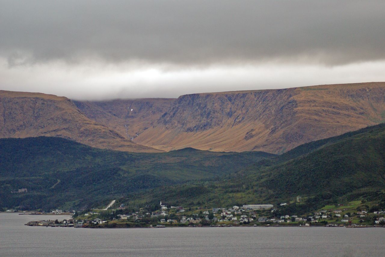
Gros Morne National Park is a wonderland for geologists and hikers alike. One of its best-known features is a range of flat-topped hills beside Route 431 just outside the town of
Woody Point -- a spot known as the Tablelands. The rusty orange tone of the hills comes from the peridotite that is their main component; when it's freshly exposed, this rock is a dark grey-green, but with oxidation it takes on a mellow golden tone. This rock is part of an exposed section of the earth's mantle; further metamorphic activity turns it into a rock called serpentinite, examples of which can be widely found here.
 |
| Gros Morne's Tablelands |
Earth's mantle? That's right -- this is a section of rock that was once deep below the earth's surface, formed roughly 1.2 billion years ago. The process of continental drift several hundred million years ago forced this mantle rock upward, and subsequent erosion has given the hills their present form. They remain barren because the peridotite is low in life-sustaining nutrients and contains toxic concentrations of heavy metals. What vegetation that is found here is mostly along an old roadbed, on rock that was brought in for the purpose of road building. A well-maintained trail follows this roadbed, crossing Winterhouse Brook, which flows out into Bonne Bay just outside Woody Point.
 |
| Round-leaved sundew (Drosera rotundifolia) |
A walk along this trail reveals a surprising number of small, hardy plants that have developed the survival tactics necessary for such a forbidding environment. Many of them, like pitcher plants, butterwart, and the round-leafed sundew shown at left are insectivorous; instead of obtaining all their nutrients from the soil, they attract insects and through a variety of processes absorb the life-giving substances they need from the insects themselves or from their droppings. It's not an easy life, to say the least.
 |
| Winterhouse Brook |
Continue along the trail as far as Winterhouse Brook (right), where snowmelt and run-off from the tops of the Tablelands form a swift-running stream. This area has a challenging winter climate, and a heavy snow load on the upper slopes often persists into late summer. If you think this place looks strange and otherworldly you're not alone. In fact, the landscape here is so forbidding that NASA has sent research teams here to investigate the area's similarity to the surface of Mars. On a beautiful summer day, though, it's a beautiful and fascinating little corner of Earth, and well worth a side trip. Woody Point is located on Newfoundland and Labrador Route 431, about 70 km from the town of Deer Lake. It has a motel, bed and breakfast accommodations and campgrounds nearby, and there are shops, restaurants and other services, and is roughly an hour away from Rocky Harbour. Parks Canada's
Discovery Centre has high-quality informative displays, park information and a gift shop.
 |
| Woody Point and the Tablelands |